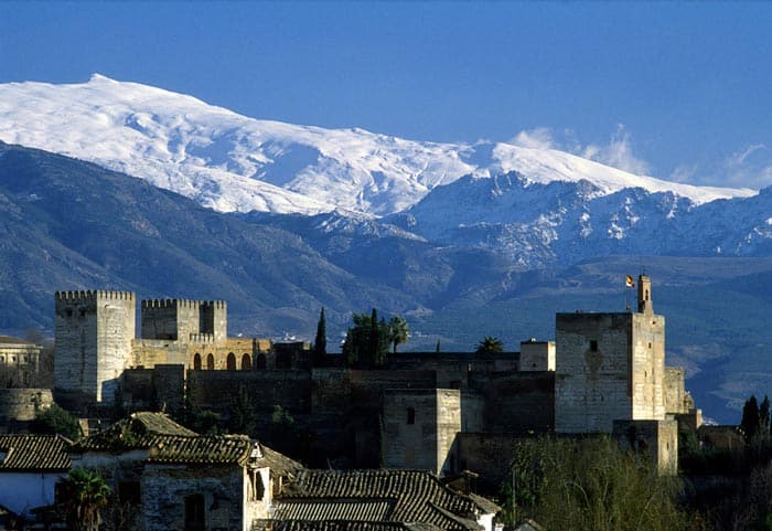
Together with Doñana Natural Park in the province of Huelva, the mountain range of the Sierra Nevada of Granada is by far the most famous and visited nature park in all of Andalusia. I’ll go further: personally, when it comes to nature walks, the Sierra is only matched by the Caminito del Rey and El Torcal, both in the province of Malaga. You don’t need to be an avid hiker, though, to succumb to the charm of the Sierra’s snow-capped peaks that frame the Alhambra of Granada: it’s a view far too evocative to leave anyone indifferent.
Of course, not everyone manages to combine a visit to the city with a day trip to the nearby Sierra mountains, but I think it’s very useful to provide information on how to get to the Sierra Nevada National Park, on the most famous trails available (with routes, timings and difficulty) and on the summer and winter activities you can do on the summits of this spectacular mountain range.
Contents
Where is the Sierra Nevada located?
The Sierra Nevada is in Spain, in our beloved Andalusia: as mentioned, we are in the province of Granada, to the south of the city.
How to get there from Granada?
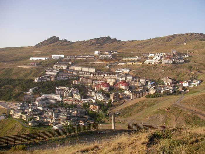
The Visitor Centre of the Parque Nacional de Sierra Nevada “El Dornajo” is less than 40 minutes from Granada, but you’ll get a better idea of the actual distances by putting the coordinates of the rather ugly mountain resort of Pradollano (50 min.) into your sat‑nav — it is the reference point for skiing activities and for the main hikes in the Sierra Nevada: this is where you can leave your car before setting off on foot.
To reach this location by car you should join the Autovia Sierra Nevada–Costa Tropical; at the junction with Motril keep right, following the signs for Ronda Sur–Sierra Nevada (the name by which this road is known is Carretera de la Sierra). From that turning you should follow the Carretera (A-395) for 23 km (about 25 minutes). Along the road you’ll also find the turn-off for Canales, a small village that offers some wonderful views over the surrounding countryside, enhanced by an artificial lake (Embalse de Canales).
If you don’t have a car, you can use the bus service provided by the company Tocina. Buses depart from Granada’s Carretera de Jaén station and reach the Pradollano station. Tickets can be purchased on the company’s website at a cost of around €5.
Here are the timetables during the winter (more precisely during the ski season):
- From Granada towards Pradollano:
- da lunedì a venerdì: 8.00; 10.15; 17.15
- sabato, domenica e festivi: 8.00; 10.15; 15.00; 17.15
- From Pradollano towards Granada:
- da lunedì a venerdì: 9.00; 16.00; 18.30
- sabato, domenica e festivi: 9.00; 13.00; 16.00; 18.30
For the rest of the year, however, there is only one bus a day that leaves Granada at 9:00 for Pradollano and departs Pradollano at 17:00 to return to Granada.
Where to stay?
The Sierra Nevada has many ski runs: the main resort is called Sol y Nieve (or Solynieve). This resort is located in Pradollano, which therefore remains the main base for anyone wishing to visit the Sierra Nevada both in summer and in winter: besides a variety of restaurants and a good number of hotels to suit all budgets, here you can hire equipment for winter sports and book sporting entertainment activities and more.
Below you’ll find all the hotels available in Pradollano and some tips in case you instead want to find a hotel in Granada.
Find accommodation in Pradollano
Advice on where to stay in Granada
Some good alternatives:
- Halfway between Granada and Pradollano is Cenes de la Vega. Not much to write home about as a place, but strategically it’s one of the best choices.
- North-west of Pradollano are the aforementioned Canales, Güéjar-Sierra (20 minutes north of the Visitor Centre) and Monachil (30 minutes west of the Visitor Centre). A family-friendly walk starts from Monachil: Los Cahorros, a route along the Monachil river that takes place largely on suspension bridges. It can also be reached by bus: bus line 183, departing from Paseo de los Basilios in Granada.
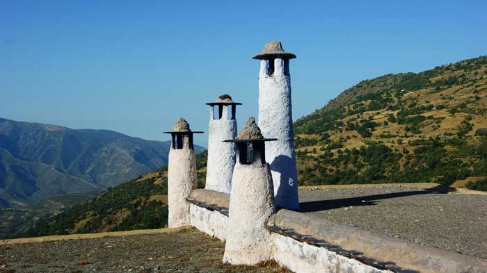
- On the southern side of the Sierra – a splendid region called La Alpujarra – I recommend Capileria and Trevélez (the municipality with the highest altitude in all of Spain), but in this case you will no longer need to use Pradollano as the reference point for hikes.
- For long hikes, you’ll find a list of the available mountain huts in the following paragraphs.
Sierra Nevada Hiking Trails (Pradollano)
It’s worth remembering that the Sierra Nevada is home to the most southerly ski resort in Europe, so you should carry sun protection at any time of year. You should also carry water and food if you plan to undertake the more strenuous hikes.
La Veleta
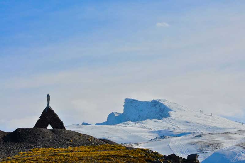
The most famous hike in the Sierra Nevada departing from the Pradollano ski resort takes you to the summit of La Veleta, at an altitude of 3,394 mt above sea level. From the car park you follow the path which, after just 600 metres, reaches the monument to the Virgen de las Nieves and then climbs up to the summit (a little over 5 km (3.1 miles) from the start and roughly 3 hours’ walking, as it is a steady ascent with the final stretch very steep). You then descend to the Refugio de la Carihuela and the Lagunillos de la Virgen, before dropping down to rejoin the initial path for the final section and complete the circuit.
- Starting point: car park Hoya de la Mora (here)
- Duration: approximately 5–6 hours (circular route)
- Difficulty level: moderate to high
- Length: 13.4 km (8.3 miles)
- Elevation gain: 830 m
Mulhacen
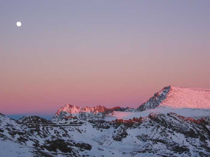
The highest summit of the Sierra Nevada is the Mulhacen which, together with La Veleta and Mount Alhambra, forms Las Tres Cumbres. Mulhacen isn’t content with just the Sierra’s record: with its 3482 mt above sea level it is, in fact, also the highest summit of the entire Iberian Peninsula.
- Starting point: see above. Since to get to Mulhacen you must first reach the Veleta and then walk on for many kilometres, I recommend using the shuttle service to shorten the hike.
- Duration: from Hoya de la Mora, about 6 hours (one way)
- Level of difficulty: from medium to high. If you decide to reach the foot of the mountain (at the Vivac de la Caldera refuge) the trail is comparable in difficulty to the hike to La Veleta. If, instead, you climb all the way to the summit, you will have to gain 400 m in just one kilometre: this additional section is recommended for experienced trekkers, as there are some via ferrata sections.
- Length: approx. 19 km (11.8 miles) (one way)
- Elevation gain: variable, see “level of difficulty”
Laguna de las Yeguas
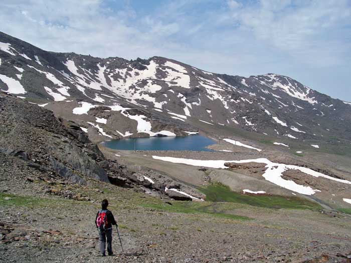
Considerably shorter and less strenuous is the hike that leads to the lake called Laguna de las Yeguas: it is only possible in summer, when the ski lifts are open (operating from 10:00 to 18:00 from June to August).
- Starting point: take the Ski lift at Pradollano station. The trail starts as soon as you get off the lift. The trail finishes in Pradollano.
- Travel time: approximately 1.45 hours (one-way)
- Difficulty level: easy
- Length: aabout 5.7 km (3.5 miles) one way
- Elevation change: the trail is predominantly downhill (430 mt) and only partially uphill (81 mt)
