Are you planning a trip to Andalusia and, besides the sunny Andalusian beaches, are you also looking for scenic villages perched in the mountains and perhaps a few lovely walks in nature? The Sierra de Grazalema is one of those destinations you don’t expect when visiting this region: here you can find canyons cut into the rock, evocative caves and streams running through lush woodland.
In short, an unexpected and alluring place, perfect to include on a road trip with stops in some of the region’s most beautiful villages, but also ideal for those who want to base themselves in one spot to dedicate time to hiking and a slow-paced holiday.
Contents
Sierra de Grazalema Natural Park
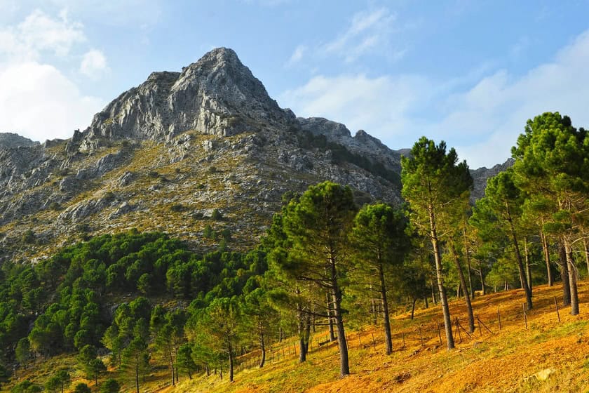
The Parque Natural Sierra de Grazalema is a protected natural area covering more than 53,000 hectares, situated in the eastern part of the province of Cádiz and partly in the neighbouring province of Málaga. It stretches across the Serranía de Ronda mountain range, but also includes smaller ranges such as the Sierra del Pinar and the Sierra del Endrinal. The highest peak within the park is El Torreón (or Pico del Pinar), at 1,648 m. There are roughly 20 mountain summits exceeding 1,000 metres. This mountainous area is among the wettest parts of Andalusia: moist winds from the sea meet the mountain barrier and release their rain here, making these zones very damp even when nearby areas are dry and sunny.
Being composed mainly of limestone, these mountains are characterised by karst phenomena: there are several caves, some of which are truly remarkable. Among the park’s natural highlights is the Garganta Verde (green gorge), a striking, narrow and deep canyon where it is also possible to enjoy a lovely hike (but you need a free permit, which must be requested here). The whole park area is fairly easy to visit: partly by car, as it is crossed by several roads, and partly on foot by following the hiking trails. Hiking is also the best way to appreciate its natural beauty: here the rare Spanish fir (Abies pinsapo) grows, and both griffon vultures and Bonelli’s eagles nest (also called banded eagles, an endangered species).
Where it is and how to get there
The natural park straddles nine municipalities in the province of Cadiz and five in the province of Malaga, so it can be reached from numerous directions. The best route depends on where you’re coming from and which destination within the park you intend to reach, because the various villages and attractions are separated by the mountains, so not all roads are the same. Bear in mind that to reach the park boundary it takes just 15 minutes from Ronda (eastern border), about an hour from Cadiz (western border) and roughly an hour and twenty minutes from Seville (northern border).
Pueblos Blancos and historic villages
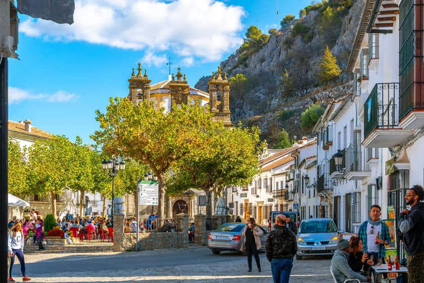
If you’re organising a road trip, bear in mind that you can explore these mountains even without having to go hiking. There are in fact several small towns worth stopping at along the way. Some are among the Pueblos Blancos of Cádiz, but there are also others to discover. Starting from the northernmost part of the park, one of the best known is Zahara de la Sierra, famed for its castle perched on the rocky spur that overlooks the village.
In the central part of the park stands the village that shares the same name as the mountain area, Grazalema, famous for its intricate alleyways, its historic wool production and the characteristic bull run with a rope. A short distance away, along the same road but in the park’s westernmost area, are Benamahoma and El Bosque, less picturesque than Grazalema, but still worth a brief stop.
In the southernmost area we find the lovely village of Ubrique, known for its leatherwork and for its splendid historic centre, and not far away the tiny but characterful Benaocaz and Villaluenga del Rosario. On the south-eastern border are Benaoján and Cortes de la Frontera. There are also other villages located just outside the boundaries of the natural park and therefore easy to include on this tour, for example Algodonales, Prado del Rey, El Gastor and Benarrabá.
Caves open to visitors
Karstic features are widespread in these mountains, and there are also several caves that are easily accessible. Below we look at the most famous.
Cueva del Gato (Cat’s Cave)
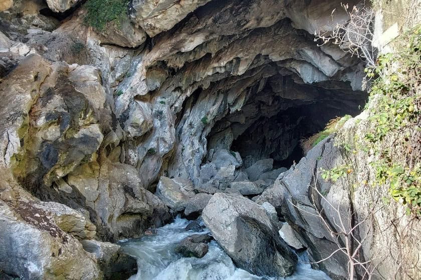
Cueva del Gato (Cat’s Cave) is not just a simple cave, but the most important cave system in all of Andalusia. It is a true wonder: a large cavity in the rock from which a cold, clear spring flows, creating small waterfalls and a little pool just outside the cave. It’s easy to visit: simply park here and walk along the path for less than 10 minutes to reach the cave.
You can even swim in the water, but be warned: it’s really cold! Access used to be completely free, but now a small charge has been introduced during the summer months: €2 for adults and €1 for children (which rise to €2.50 and €1.50 respectively at weekends). Parking is also charged in July and August (€1 per car), while it is free for the rest of the year.
Cueva de la Pileta
Not far away is another truly fascinating cave, the Cueva de la Pileta. Declared a National Monument in 1924, this cave is decorated inside with rock paintings dating from the period 28,000–8,000 BC, depicting various animals such as cattle, goats, deer and horses. The most famous images are “The Pregnant Mare” and “The Fish”. These rock paintings were created by Paleolithic hunter-gatherers, who probably also used the cave for burials.
To reach it you can park the car here and then walk for just 5 minutes along the path to the cave entrance, but it is closed by a gate. To enter you need to join a guided tour: on this page you can find prices, times and how to book.
Cave of the Two Doors
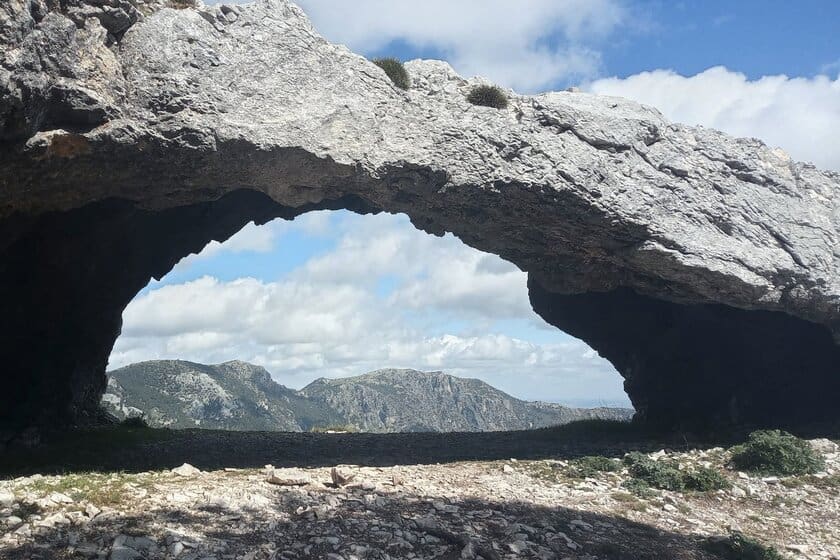
This, despite being called the Cave of the Two Doors, is not a true cave. It is more of a rock arch that creates a kind of panoramic window from which you can admire a splendid view over the valley below, where the village of Grazalema lies. To reach it you need to go for a walk, which I will describe shortly when discussing the hikes that can be done in the park.
Hikes in the Sierra de Grazalema
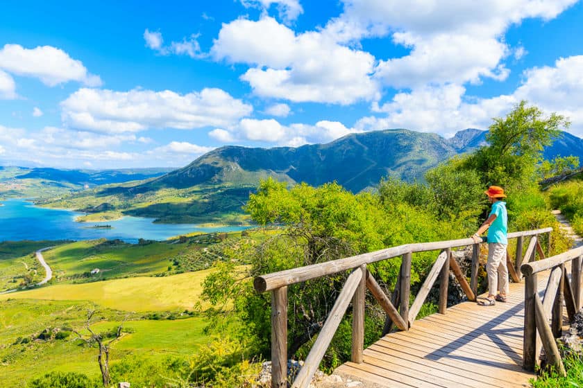
There are plenty of walks to do in the Sierra de Grazalema, from short, easy strolls to long, demanding treks. Here are a few walks you can undertake if you’re in the area and want to do a hike of a few hours during your holiday in Andalusia.
Caminito of the Knights
The Caminito de los Caballeros is a short, family-friendly route that at the same time offers magnificent views. It takes between one hour and an hour and a half to complete and leads to the Cueva del Hundidero (an evocative cave reachable only by footpath) and several viewpoints.
From the car park simply follow the path for just over 900 metres to the cave. Along the way there are three possible detours: two lead to their respective viewpoints and one to the Presa de Montejaque, or Presa de los Caballeros (a dam which currently does not form a lake, as it is dry).
Here is the junction where straight on continues to the cave, to the right is the first viewpoint (just 2 minutes away) and to the left the second viewpoint (5-10 minutes away). A little further on there is the second fork: to the left you go towards the cave, to the right towards the dam (which is less than 5 minutes away). The figures below refer to the complete out-and-back route including all detours.
- Starting point: here
- Length: 3.1 km (1,9 miles)
- Elevation gain: 176 m
- Duration: 1 hr 15 min
Puerto de las Palomas and Cerro Coros
This is a very scenic route, offering 360° views over the western area of the park. From the top you can clearly see the lake Embalse de Zahara. The walk starts from the car park at the Puerto de las Palomas viewpoint and climbs to the summit of Cerro Coros to gain a full view of the area, then returns to the starting point in a loop. A short but charming walk.
- Starting point: here
- Length: 3.2 km (1,9 miles)
- Elevation gain: 154 m
- Duration: 1 h 15 min
Ojo del Moro
Here is a route that, crossing an area characterised by limestone rock, leads to the Ojo del Moro, a rock arch that presents itself as a window onto the panorama below. The route is fairly easy and doesn’t take long, but it won’t leave you disappointed. From the car park simply follow the path to the small turn on the right that leads to the arch; continuing a little further brings you to a lovely viewpoint.
- Starting point: here
- Length: 2.5 km (1,5 miles)
- Elevation gain: 46 m
- Duration: 0:40 h
Puerto de las Presillas and Puerto del Boyar
Setting off from the village of Grazalema there are countless possible routes, but I suggest a medium‑length one that lets you visit interesting spots and enjoy panoramic views of the area’s peaks, including one of the park’s highest (Cerro del Simancòn). It starts from the western edge of the village and leads to the Puerto del Boyar, passing at the foot of the Peñón Grande and over the Puerto de las Presillas. The final section includes a few short stretches on tarmac, as the path crosses the main road several times.
- Starting point: here
- Length: 7 km (4,3 miles)
- Elevation gain: 344 m
- Duration: 2:30 h
Cueva de las Dos Puertas, Ermita del Calvario and Mirador del Santo
From Grazalema you can also follow a lovely route that leads to the Cueva de las Dos Puertas, then passes by the Ermita del Calvario and the viewpoint Mirador del Santo. A very pleasant route, offering an excellent view over the village of Grazalema and the surrounding mountains. If you intend to reach only the rock arch Cueva de las dos Puertas and return without doing the whole loop, bear in mind it’s about 3.5 kilometres (2,1 miles) there and back and takes roughly half an hour in total.
- Starting point: here
- Length: 5.4 km (3,3 miles)
- Elevation gain: 335 m
- Duration: 2 h 20 min
Majaceite River Trail
For a shady walk, there’s the trail that runs along the course of the River Majaceite, between the village of Benamahoma and that of El Bosque. It’s a shaded path along the stream where you can see small waterfalls, cross the water on wooden footbridges and even cool off in the cold water. Along the route are also the ruins of an old mill. The total route from one village to the other and back is almost 9 km (5,5 miles), but you can easily turn back earlier to reduce the distance.
- Starting point: here
- Length: 8.8 km (5,4 miles)
- Elevation gain: 140 m
- Duration: 2:30 h
Where to stay
Would you like to visit the Sierra de Grazalema at your leisure, without missing any of its beauties? If so, I suggest spending at least one night inside the park, staying in one of the mountain villages, where you can find both hotels and apartments. On the map above you can see all the accommodation available in the area, but below you’ll find the places to stay in the main towns:
